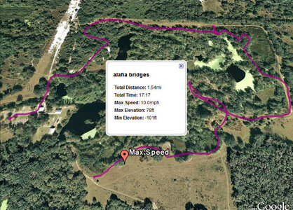
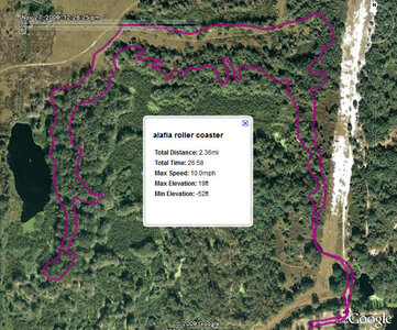
Here is the track along with elevation/speed profiles of my ride today.
It was 2.45 miles and took me 24 minutes at an average 6mph.
I used gpslogger on my Blackberry, sweet little free program.
Jett, I have the BB Tour, and I can't find GPS LOGGER in app world- is that the name of it, and where can you get that? Pretty sweet...